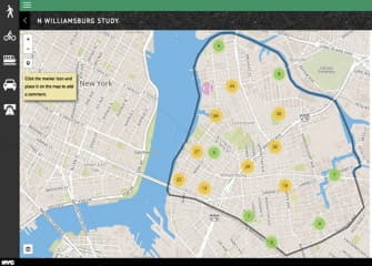
The DOT's interactive Map of North Brooklyn
How would a government bureaucrat know that the stoplight on Metropolitan and Marcy takes “far too long to arrive, and cars making left turns don’t respect the pedestrians crossing Marcy”?
They likely wouldn’t. How do you measure annoyance in data?
Said bureaucrat likely also wouldn’t know that on the Queens side of the Pulaski Bridge “an insulation warehouse consistently uses the bike lane and bus stop for a loading area, causing congestion.”
READ FULL ARTICLE HERE

